Southwest Wilderness delight
The Crossing River, Tasmania
INTRO
The Crossing River is a true multi-day wilderness packrafting journey, via a multimodal traverse across spectacular scenery of Tasmania’s Southwest National Park and on into Port Davey/Bathurst Harbour. This trip requires good preparedness and advanced route planning. Suited for backcountry hikers with the appropriate experience in offtrack navigation and similarly, paddlers with remote area wilderness experience. Understanding and interpretation of weather forecasts, tides and swell conditions are paramount for a successful trip into this region.
HOW TO GET THERE
The Crossing River/Port Davey packrafting trip typically starts from the trail head of the Western Arthurs/Port Davey track at Scotts Peak Dam on the Southern end of Lake Pedder. Roughly a 2.5hr+ one-way drive from Hobart airport. There is a basic campsite at the trailhead, where trip intentions can be lodged (recommended).
As this trip is generally completed as a through hike/paddle, with a return air transfer out of Melaleuca back to Hobart/Cambridge, arranging a drop off to the remote Scotts Peak Dam is advisable. If you’re unable to convince a friend to drop you off, Tasmania Wilderness Experience offers a shuttle service from Hobart/Hobart airport with prior booking.
Alternatively, if you’re driving in a single car, the trip can be altered and completed as a circuit loop, taking advantage of the Port Davey Track back to Scotts Peak Dam. We recommend the full through trip to Melaleuca, which takes in paddling through the spectacular Bathurst Channel into Bathurst Harbour.
WHERE TO GET SUPPLIES
New Norfolk or Greater Hobart will be the best full service towns to obtain supplies prior to heading into the wilderness. There are numerous outdoor shops in Hobart, where dehydrated meals and stove fuels can be purchased, if required.
The Westerway Service Station will be one of the last refueling stops along the road out to Scotts, check the opening times or fill up closer in to Hobart.
Last EV Charging is available in Maydena at the Fika Time Cafe General Store (ChargeFox Station #5295 - 24kW DC or BYO 22kW Type cable).
If continuing your journey along the South Coast Track from Melaleuca, resupplies/gear freight are possible through Par Avion with prior arrangement, for a per kg fee. You can also arrange for liquid fuel/gas canister resupply at Melaleuca, again through Par Avion.
Drinking water is easily sourced along the hike into the Crossing River and along the route, however ensure to top up drinking supplies prior to reaching the lower brackish tidal sections proceeding the Davey Gorge. Some minor streams with potable water can be found along the shoreline around Port Davey, however scrub bashing is likely required to get above the estuarine areas, for saline free drinking supplies. Much easier to stock up prior to entering the coastal areas, and easily transported in your packraft.
Trip SECTIONS
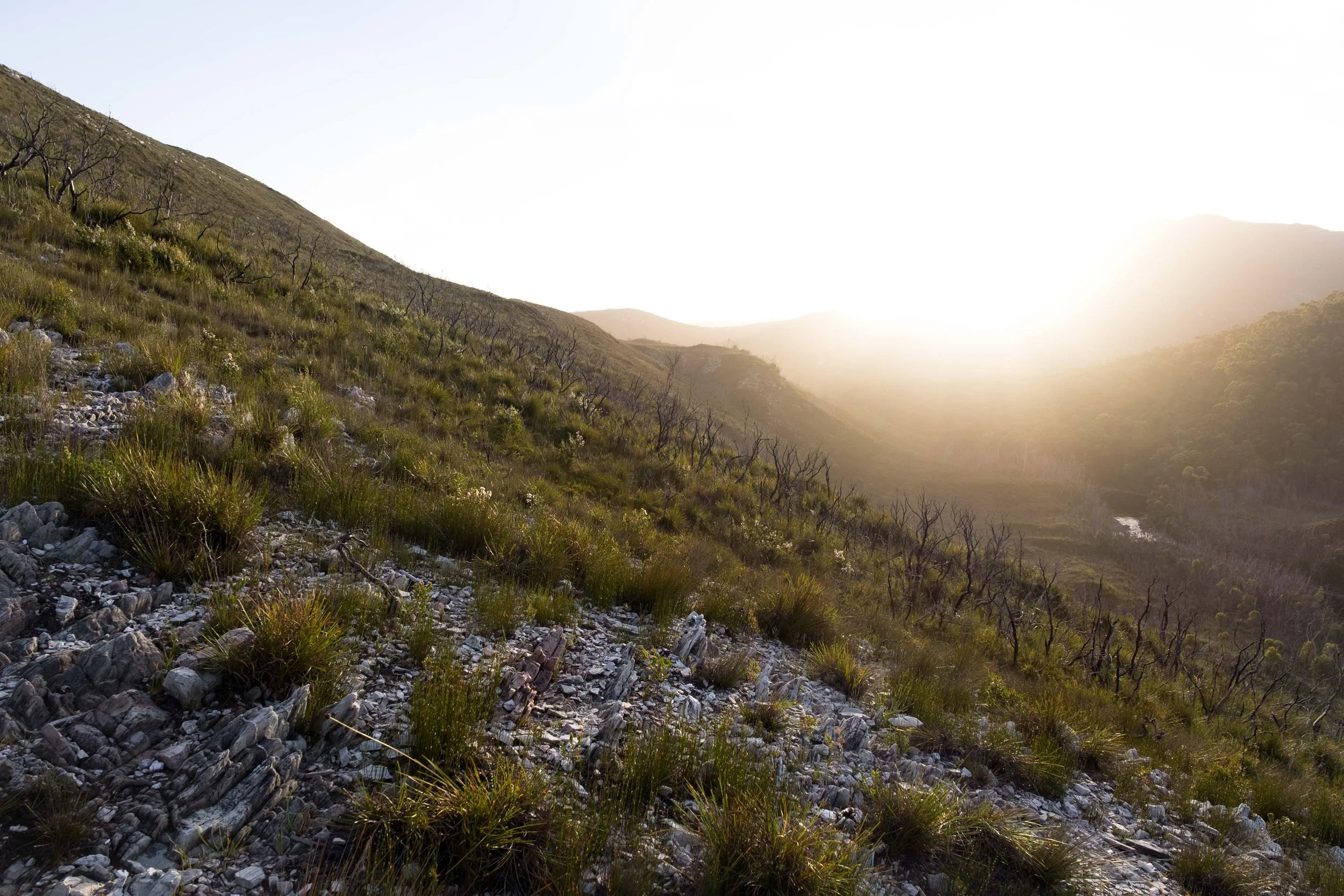
Departing from Scotts Peak Dam on the southern edge of Lake Pedder, 1-2 days hike along the Port Davey Track takes in views of the Western Arthurs Range. It is advisable to put in on the Crossing a number of km’s below where the Port Davey Track intersects the river, requiring a section of off-track hiking to access the river.
The upper sections of the Crossing have numerous log-jams and sections requiring rapid scouting, along with some mandatory portaging over complex bouldery terrain. Lower sections of the Crossing and on into the Davey River provide more mellow paddling, with some rapids, interspersed with long flat water sections. After the last rapid near the Davey Gorge, paddling is flat and can be a bit of a slog with a headwind.
Packrafting across Payne Bay/Port Davey can be achieved by nearshore paddling in a clockwise direction onto Bathurst Harbour via the spectacular Bathurst Channel. With favourable tide/wind/swell conditions, a more direct open-water route for the entrepid and appropriately skilled/prepared may also be possible from Settlement Point across to Berry Head (proceed with caution and know the current weather/tide forecast). A packable windsail may be adventageous should the conditions be favourable. Due to the exposure from weather and swell often raging off the Southern Ocean, particularly nearing Bathurst Channel, hugging the coastline is generally advisable. From Berry Head, paddling on the lee side of Kathleen Island is also advisable under most situations to avoid larger swell. Note: Open water conditions can change suddenly in this remote location and waiting out for more favourable weather at a dispersed wilderness shoreline camp may be required, so plan food/water/trip duration accordingly. Allowing a 1-2 day buffer to reach your end point should generally be fine, but we are aware of some trips that have blown out considerably due to unfavourable weather or river conditions.
The Crossing River trip can also be varied as self supported loop, with a hike back up north to your vehicle parked at Scotts Peak Dam, via walking the Port Davey Track from Farrell Point prior to entering Bathurst Harbour.
If you’ve been able to organise a drop off/transport to start your trip at Scotts Peak, continue paddling through and on into Bathurst Harbour to the remote airfield of Melaleuca. Experienced hikers/paddlers should allow for 5-8 days for the entire section from Scotts Peak to Melaleuca in favourable conditions. Trip duration will be dependent on desired level of effort each day and climatic and river conditions.
A flight back to Hobart/Cambridge can be taken with Par Avion to complete your trip from Melaleuca. Flights are run on a daily schedule in peak times and on demand charter is also available (both weather permitting). Advanced bookings are generally required.
For the more intrepid with additional time, the Crossing River/Port Davey packrafting trip can be extended for another 7-8days by linking with a hike along the South Coast Track through to Cockle Creek. If completing the entire Scotts Peak to Cockle Creek trip, midway resupplies/gear drops/pickups are possible with advanced planning and coordination with Par Avion. Likewise transport can be arrange at the end of your trip from Cockle Creek back to Hobart/Hobart Airport.
TRIP PLANNING RESOURCES
Online map routing resources available on MapList here
Good selection of hardcopy topographic maps available from Hobart's Geographica online and in-store, or The Chart & Map Shop over in Fremantle can also be a good resource for paper maps and deliver Australia wide.
Charter flights and Resupplies with Par Avion here
Southwest National Park, Parks Tas info here
South Coast Track details here
Need advice on a suitable packraft option for a trip like the Crossing River/Port Davey trip, give the team at Pack Raft Australia a call on (03) 9039 6224 and we’ll be more than happy to give some advice and run through the Alpacka Raft packrafts which suit a trip like The Crossing.
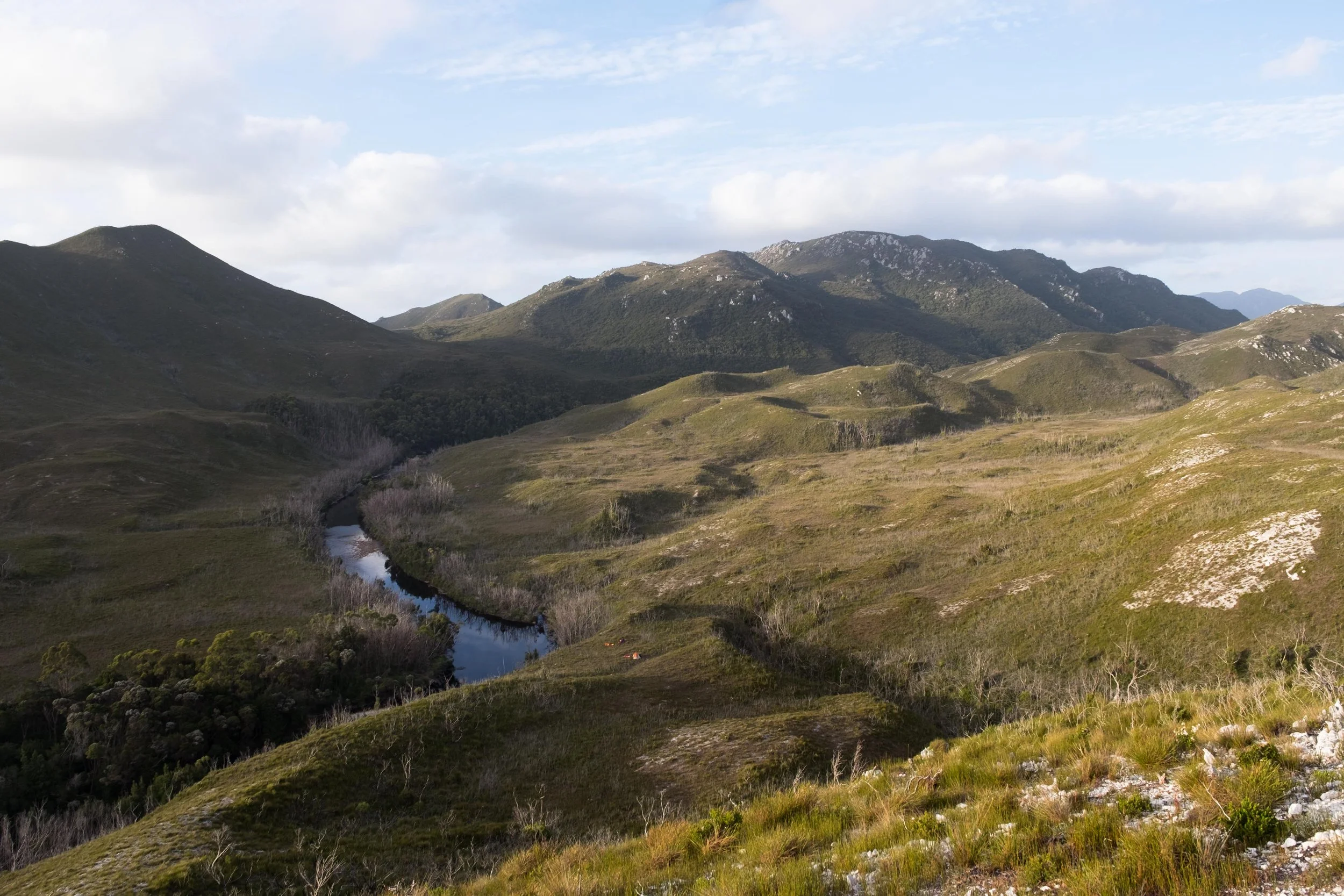
River view of the Crossing/Davey River in Tasmania’s Southwest Wilderness National Park
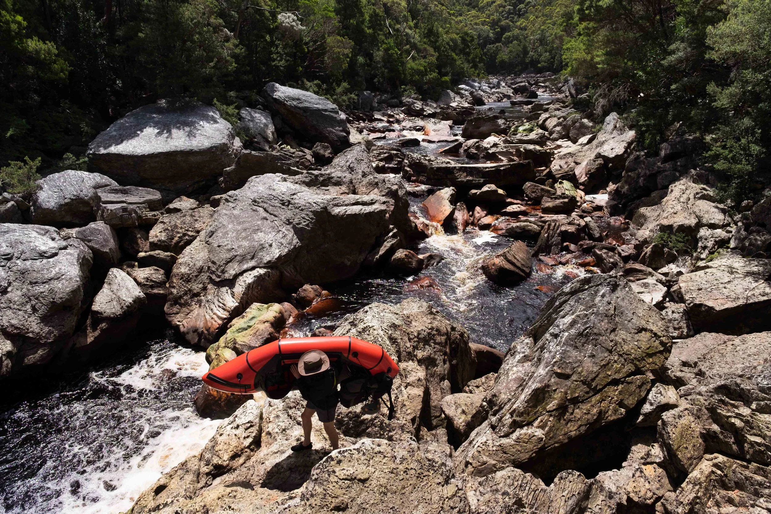
Portaging packrafts over boulder rapids on the Crossing River, Tasmania

Relaxing in packrafts with the presence of fine weather, upon reaching Payne Bay/Port Davey, Tasmania