Solitude in the hills
Caledonia River, VIC
INTRO
The Caledonia River is a remote, seasonal river delivering outstanding, consistent and fun paddling. From the river put-in, through to the take-out, this river affords those who venture into this isolated valley, quality on river paddling. This river is truly the domain of the packrafter, who can easily carry in their lightweight packrafts, paddling gear, camping and other supplies, all inside a backpack throughout the hike-in only access of prime paddling season. Getting to the put-in is obtained with a relatively straightforward, 15km hike down a series of seasonally gated, steep 4WD only access tracks (vehicle tracks in the area are open during the summer months, however the riverbed resembles more of a shallow stream during this period). The upper catchment of the Caledonia starts in the Howitt Plains area, where numerous small feeder creeks converge, gradually building volume, as the river tumbles south off the Great Dividing Range through traditional lands of the Gunaikurnai People. All creating a relatively consistent series of grade 2-3 rapids and all day wave train paddling. Good levels on this river occur after solid winter snowmelt or heavy spring rains. The entire Caledonia journey is an honest packrafting trip. Unpretentious, scenic and just generally fun.
HOW TO GET THERE
The Caledonia River is accessed via the sleepy township of Licola, on the banks of the Macalister River in Victoria’s East Gippsland region. Take a hard right onto Tamboritha Road, just before the bridge coming into Licola. The road contours along the Wellington River for the first ~22km (another river in the area worth a paddle after some decent rains). Where the road peels away from the river and starts gaining elevation into the high country (also the start/end point of the Lake Tali Karng hiking trail), you’ll be driving on an unsealed gravel road, for a further 24km until you reach Arbuckle Junction. Take the left fork onto Howitt Road and head further up into the Snowy Plains area. There is a large gravel clearing, a couple hundred meters prior to hitting the Howitt Road/Kelly Hut Track Junction. Park up and this is your trip start point.
WHERE TO GET SUPPLIES
If your journey begins in Melbourne, Traralgon will be your last full amenity town to for groceries, 24hr food/fuel, EV fast charging and also has a couple of camping stores for last minute camp stove gas supplies, if required.
Coming from the East, Sale will be your last major town for groceries, 24hr food/fuel and EV fast charging.
The Licola General Store is your last opportunity to top up with fuel, if required.
RIVER SECTIONS
The Caledonia River is a multimodal trip, and requires a 15km hike along a series of 4WD access roads, down to the river put in. The first 13km’s are straightforward and easy walking, across alpine plateau and down through undulating, forested terrain on Kelly Hut Track, Scrubby Hill Track and eventually Dingo Hill Track. Dropping a sharp 900m in elevation over the final 1-2kms of Dingo Hill Track, as you descend to the spectacular river valley below (steep and heavy on the knees! Hot in the midday sun). The hike can be completed in a single day. Alternatively, and better suited to paddlers journeying to the area from further afar, simply walk an easy 3.5km along Kelly Hut Track from your car, and camp at McMichael’s Hut, with an early dinner and fireside whiskey. A night at the hut leaves a manageable 3-4hrs hike the next day, allowing you to get on river by morning tea, or lunch (depending on how rowdy McMichaels got the night proceeding). Where Dingo Hill Track fords the Caledonia River, transition from backpacking and setup packrafts. If you’re super keen, you can also ford the river and continue hiking further North up along the Caledonia, where Dingo Hill Track contours the river for numerous kms. The upper sections of the Caledonia can be a bit chocked with tree fall and may not be worth the extra effort though.
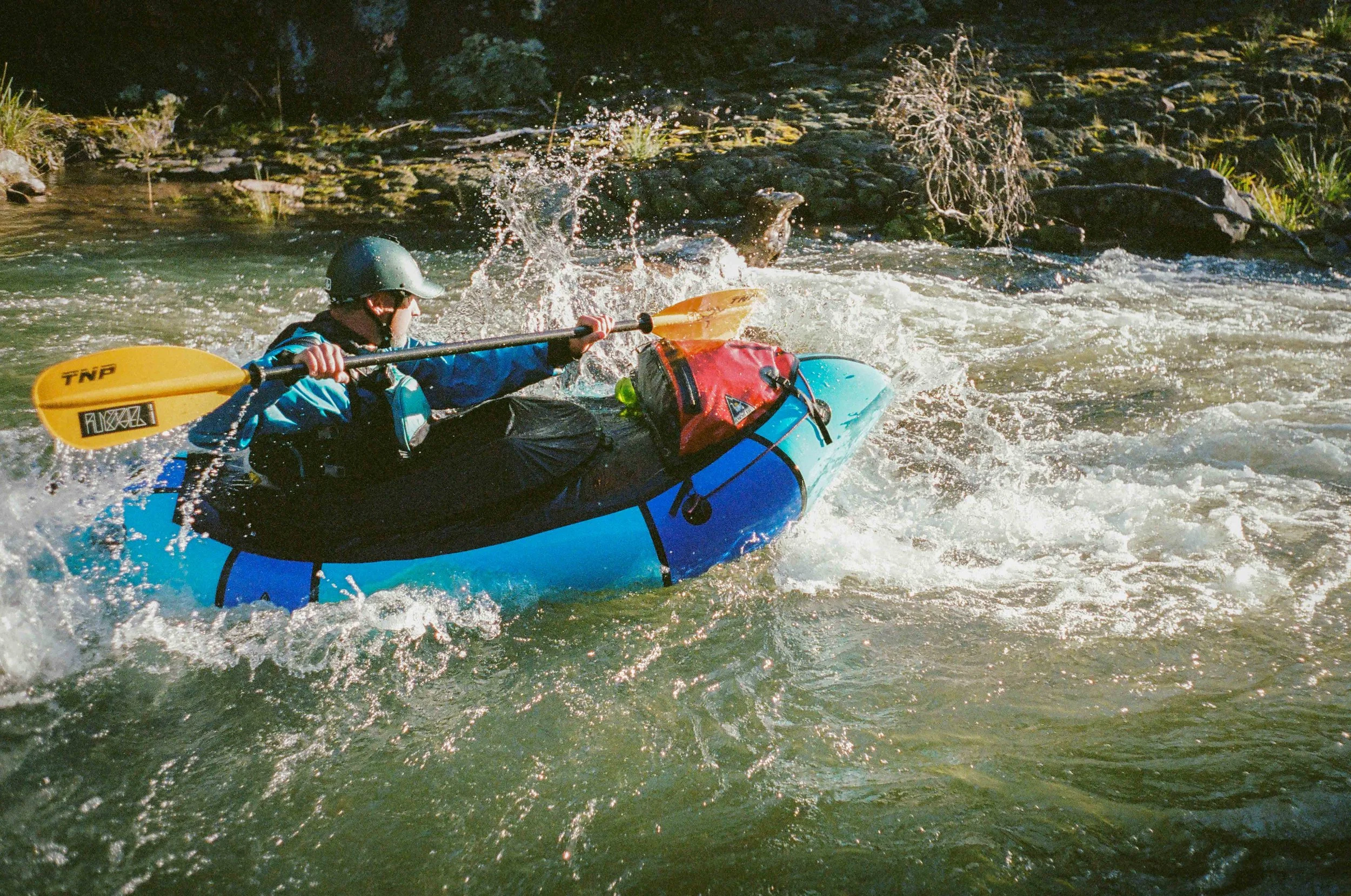
The approximately 32km paddling section from Dingo Hill Track down to Licola bridge, is all mild grade 2-3 rapids, and wave trains nearly for the entirety of run. Ample dispersed riverside bush camp options exist, with the section easily done over 1.5days. Depending on the season, some debris/tree fall may be present, so keep a look out for branches and logs. The river does seem to do a relatively good job of clearing most debris away after heavy rains/flooding. There are no major rapids of note, with higher flows, the river will feel narrow, pushy and quick.
The final section on the journey joins the Macalister River, from the confluence with the Barkley River down to Licola. This section is a bit of a bore, especially after the good times of the Caledonia. You can shorten this final section by leaving a car riverside near the confluence of the Macalister and Wellington Rivers, on river left. Alternatively leave a vehicle river right, at the Barkley River Camp site, and hike up from the confluence of the Barkley/Macalister Rivers to finish your trip.
TRIP PLANNING RESOURCES
BOM River Level Graph here - Pack Raft Australia recommends running the Caledonia in a packraft when the gauge levels are 0.90m or above.
Some additional information and trip planning resources over on WikiRivers here (Note: The WikiRivers write up is from the perspective of hardshell boaters, who endured a long drag in for their heavy Kayaks and camping kit.This simply highlights, The Caledonia is truly the domain of the packrafter!)
Need advice on a suitable packraft option for a trip like the Caledonia River, give the team at Pack Raft Australia a call on (03) 9039 6224 and we’ll be more than happy to give some advice and run through the Alpacka Raft packrafts which suit a trip like the Caledonia.
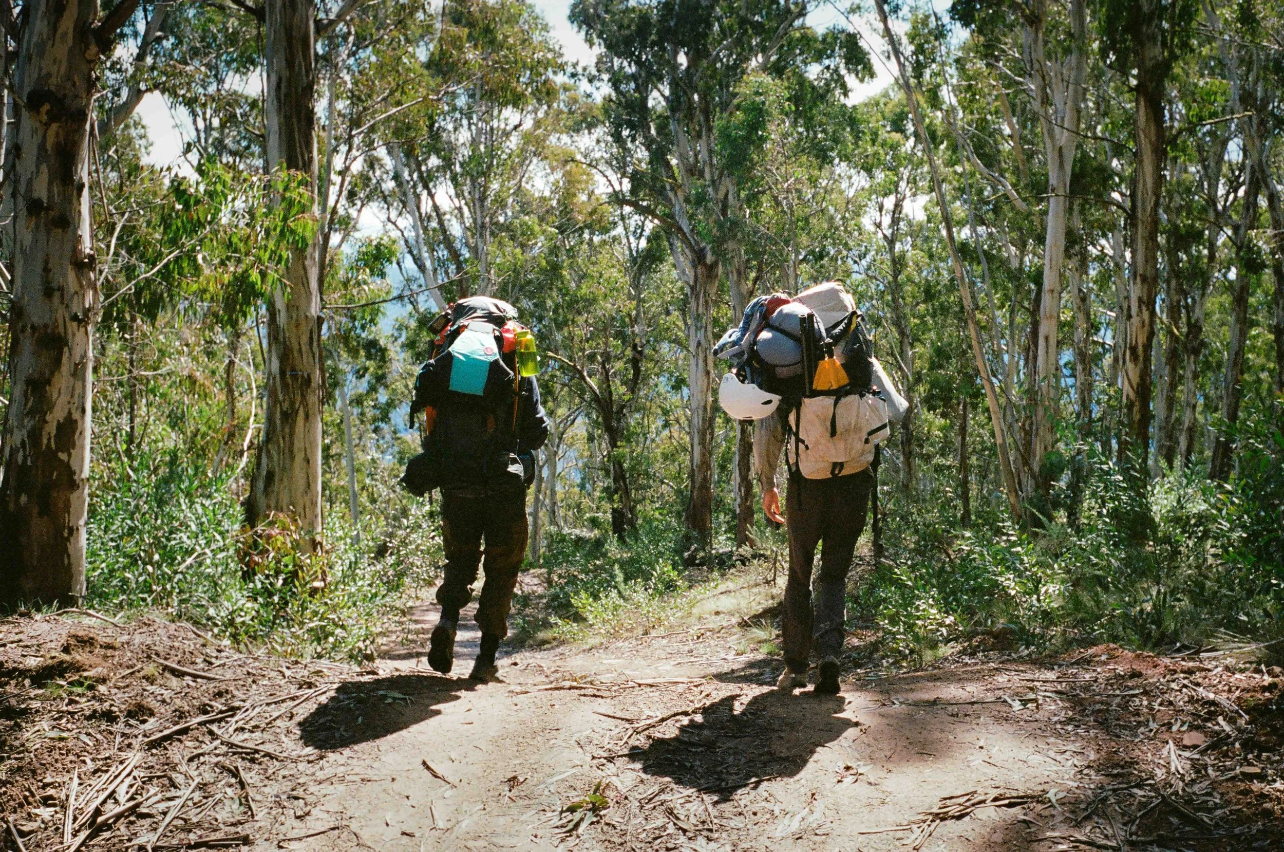
Commencing the descent down to the remote Caledonia River valley

Riverside tree fall and packrafting along the Caledonia River, Victoria

Alpacka Raft packraft’s, the Kings of the Caledonia River, Victoria